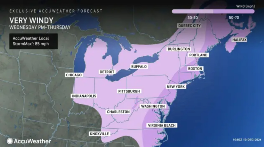
It’s time to make sure your outdoor Christmas decorations are tightly secured. Strong winds from a powerful storm system will be whipping across the New Jersey region on Wednesday, with the storm also expected to bring 2 to 3 inches of rain.
That’s the word from the National Weather Service, which has issued a wind advisory for nine counties in the Garden State: Atlantic, Bergen, Burlington, Cape May, Essex, Hudson, Monmouth, Ocean and Union.
The weather service says gusts could blow as high as 45 to 50 mph at times, and AccuWeather says occasional gusts could even get as strong as 60 to 70 mph in some locations.
The wind advisory will be active from noon to 8 p.m. on Wednesday in most of those counties and noon to 10 p.m. in the northeastern counties.
“Gusty winds will blow around unsecured objects,” the weather service noted in its advisory. “Tree limbs could be blown down and a few power outages may result. Winds this strong can make driving difficult, especially for high-profile vehicles.”
The agency says drivers should use extra caution and homeowners should secure outdoor objects to prevent them from blowing away or causing damage.
The rain and wind will be generated by a strong storm system and cold front that’s moving east from the Great Lakes. Forecasters from AccuWeather say the central pressure of the storm might drop very quickly in 24 hours, causing the storm to intensify into a “bomb cyclone” over the Atlantic Ocean.
A “bomb cyclone” is a storm system that rapidly strengthens as cold air collides with warm air and the storm’s atmospheric pressure drops. The intensification process is technically called bombogenesis, which is how the term bomb cyclone originated.
In addition to the gusty winds, the storm will deliver a much-needed soaking to our region.
Flooding in urban areas and areas with poor drainage is possible, but widespread flooding is not a concern because of the ongoing severe and extreme drought conditions across the state. Water could also pond on roads, complicating travel.
“Wednesday is shaping up to be a very wet day up and down the I-95 corridor from northern Florida all the way to Maine,” AccuWeather.com said. “Both the morning and evening commutes … can be slowed by downpours, which can also cause localized flooding.”

New Jersey is expected to get 2 to 3 inches of rain from a large storm system that’s moving in from the Great Lakes on Wednesday. Forecasters from AccuWeather say the storm may intensify into a “bomb cyclone” as it moves over the Atlantic Ocean.AccuWeather
Rain will finally push out from west to east on Wednesday night into Thursday, though gusty winds will stick around Thursday on a very cold day.
With a cold front bringing frigid air from Canada, high temperatures on Thursday will be stuck in the low 30s in northwestern areas of New Jersey and the mid- to upper 30s in other parts of the state.
Plus, the gusty winds will make it feel about 10 degrees colder even though the sun will be out.
Current weather radar

Thank you for relying on us to provide the local weather news you can trust. Please consider supporting NJ.com with a voluntary subscription.
NJ Advance Media staff writer Jeff Goldman contributed to this report.
Len Melisurgo may be reached at LMelisurgo@njadvancemedia.com or on X at @LensReality.

