Published on January 14, 2025
Draft Maps Provide an Early Look at Updated Flood Hazard
The New Jersey Department of Environmental Protection (NJDEP) and the Federal Emergency Management Agency (FEMA) have released updated draft flood risk data for Morris County, providing residents and local officials with an early look at the latest flood hazard information.
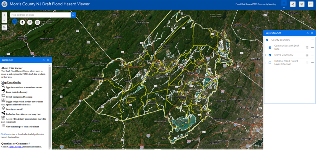
The draft flood data is accessible through an online viewer.
While the viewer does not include a public comment feature, it allows users to preview updated flood risk details ahead of the preliminary maps, expected in spring 2025.
This data, part of the ongoing Flood Insurance Rate Map (FIRM) project, reflects the latest engineering analysis of how water flows and accumulates during floods. FEMA and the NJDEP contend the updates are a critical step toward developing accurate flood maps that help communities make informed decisions to protect lives and property.
Municipalities will have additional opportunities to provide feedback before the maps are finalized by federal and state authorities. Input from the public and local officials ensures that the maps are as accurate as possible.
FEMA and NJDEP stress the importance of accurate and up-to-date flood risk data in helping communities prepare for and mitigate flooding. Both agencies encourage residents and local leaders to review the draft data and actively participate in the process to improve flood awareness and resilience.
Residents should direct their questions to FEMA, NJDEP, or their municipal offices.
For more information, visit FEMA’s Geoplatform or contact NJDEP at 877-927-6337 or FEMA Region 2 Office at 212-680-3600.

###
Image: Screenshot of the online page for the Morris County draft flood hazard viewer developed by the NJDEP and FEMA.

